Drilling without first understanding the ground is a costly gamble. A hydrogeological survey brings geological, groundwater and site information together so that drilling can begin from the most informed location available.
What is a hydrogeological survey?
A hydrogeological survey assesses groundwater conditions at a site. It considers geology, groundwater information, landform and, where appropriate, geophysical measurements to identify suitable areas for borehole development.
What information can the survey provide?
- Potential groundwater-bearing zones
- Recommended drilling location
- Estimated target depth or depth range
- Likely geological formations
- Expected drilling conditions
- Groundwater development recommendations
- Information useful for planning and regulatory applications
A survey reduces uncertainty; it does not guarantee water
Groundwater is a natural system. Even a well-prepared assessment cannot promise an exact yield before drilling. Its value lies in reducing uncertainty by combining available evidence and professional interpretation.
Be cautious of anyone presenting groundwater detection as an absolute guarantee.
Why survey information affects cost
Estimated depth affects drilling time, casing, pump cable, pipe length and pumping head. Likely geology also helps the contractor plan suitable equipment and mobilization.
Read our guide to borehole drilling cost in Kenya for the wider budget picture.
Hydrogeological surveys and WRA permitting
WRA states that water-use permit applications include hydrological or hydrogeological assessment reports among the required attachments. Review the current WRA permitting requirements before proceeding.
What happens after the survey?
After authorization, the next stage is borehole drilling. Actual formations and groundwater strikes are recorded during construction.
After development, test pumping establishes borehole performance and helps guide pump installation.
Survey planning on a developed property
In Nairobi and other developed areas, the strongest groundwater target must also be practical to drill. The team should consider foundations, septic systems, overhead lines, underground services, rig access and future maintenance.
Questions to ask before commissioning a survey
- What will the final report contain?
- Will the drilling point be clearly marked?
- Will estimated depth and likely formations be discussed?
- Can the report support the applicable WRA process?
- What access information is needed?
- What happens if the best target is difficult for the rig to reach?
Why your own site should be assessed
Nearby borehole records can provide useful background, but groundwater conditions can change over short distances. A neighbour’s borehole should not automatically replace assessment of your own property.
Contact Waterline Drillers with your location and intended water use to discuss the survey and drilling sequence.
What a useful survey report should help you understand
A survey report should be more than a page showing a GPS point. It should explain the site context, the methods used, the interpretation of available geological and hydrogeological information, the recommended drilling location and the reasoning behind the target depth. Where appropriate, it should also discuss likely formations and any limitations that could affect drilling or groundwater development.
Property owners do not need to become hydrogeologists, but they should be able to read the report and understand the main recommendation. Ask the surveyor to explain unfamiliar terms and point out the proposed drilling location physically on the property.
Survey accuracy and the meaning of probability
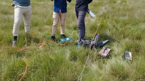
Groundwater exploration deals with incomplete information. Geophysical instruments measure physical properties of the ground and professionals interpret those measurements together with geological knowledge. The result can identify promising zones, but it does not allow anyone to see an underground river with certainty. This is why professional language often discusses probability, expected conditions and recommended targets rather than guarantees.
A careful interpretation is more valuable than an unrealistic promise. The survey should help make a better decision about where to invest in drilling, while acknowledging that final confirmation comes from the borehole itself.
Practical site issues the survey should consider
- Access for the drilling rig, support truck and compressor.
- Distance from buildings and other structures.
- Existing underground utilities and drainage.
- Septic systems and potential contamination sources.
- Overhead electricity lines and trees.
- Future space for pump controls, solar equipment and storage.
- Pipe route from the borehole to the tank or point of use.
The technically strongest target may need to be balanced with safety and construction practicality. On a small urban property, moving a recommended point by a short distance can sometimes make the difference between a drillable and an inaccessible site, but such changes should be discussed with the groundwater professional rather than made casually.
Why old reports from nearby properties are not enough
Neighbouring borehole records are useful because they show regional depth, geology and water occurrence. However, fractures, weathered zones and aquifer conditions do not follow plot boundaries. A nearby successful borehole can strengthen confidence in an area without proving that the same conditions exist directly under your chosen drilling point.
Use nearby information as supporting evidence, not as a substitute for a site-specific assessment and the current regulatory process.
Frequently Asked Questions
Does a hydrogeological survey guarantee water?
No. It identifies the most promising target based on available evidence, while drilling confirms actual conditions.
Is the survey useful for budgeting?
Yes. Estimated depth and likely geology help create a more informed drilling scope.
What comes after the survey?
Normally authorization, drilling, development, test pumping, pump installation and then optional solarization and storage.
Book a groundwater site assessment
Waterline Drillers provides complete borehole and water solutions from survey and drilling to pumping, solarization and storage. Contact our team to discuss your site.